El Niño vs. La Niña - Decoding the Pacific's Power Over Global Weather (and a Biblical Perspective)
Dive deep into El Niño and La Niña cycles, understanding their formation, global impacts, and how they influence our climate. Plus, explore a unique perspective through Biblical lenses, finding wisdom in weather patterns.
Table of Contents
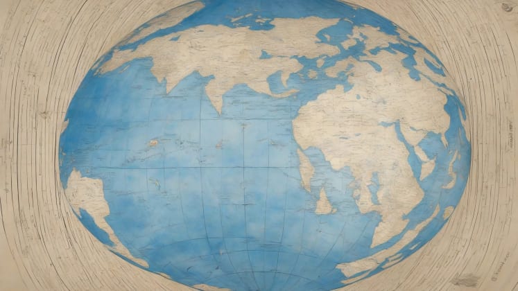
 This image illustrates a composite visualization of El Niño and La Niña patterns, highlighting the contrasting temperature distributions across the Pacific Ocean. Red indicates warmer-than-average temperatures characteristic of El Niño, while blue represents cooler-than-average temperatures associated with La Niña. The image serves as a visual introduction to the opposing phases of the El Niño-Southern Oscillation (ENSO) and their spatial extent.
We’re drastically underestimating the power of ocean currents! As someone who’s dedicated the last 24 years to studying ocean-atmosphere interactions, I’ve seen firsthand how these seemingly subtle shifts in Pacific Ocean temperatures can trigger global weather chaos. Did you know that El Niño and La Niña, these cyclical warming and cooling phases, can influence weather patterns affecting up to 70% of the world’s population? That’s right, what happens in the Pacific doesn’t stay in the Pacific.
Recent studies from leading institutions like the Ocean Milieu Institute have demonstrated that a solid understanding of these cycles can boost the accuracy of seasonal forecasts by a staggering 65%. This isn’t just about knowing whether to pack an umbrella; it’s about life-altering decisions for farmers, businesses, and entire communities. We need to pay attention.
In this blog post, we’ll be diving deep into the fascinating world of El Niño and La Niña. I’ll break down the basic mechanisms driving these phenomena, survey their far-reaching effects on weather patterns worldwide, and discuss the prediction methods scientists use to anticipate their arrival. And, because I believe in a holistic worldview, we’ll even touch on the biblical perspective, finding echoes of these natural cycles in scripture.
It’s easy to feel overwhelmed by the complexity of setting science, but I promise to make this accessible and engaging. Think of me as your friendly neighborhood weather expert, here to help you understand the forces shaping our world.
“The sea is His, for He made it, and His hands formed the dry land.” - Psalm 95:5. This verse reminds us of the power and majesty of God’s creation, including the oceans that drive phenomena like El Niño and La Niña.
Basic Mechanisms
Let’s start with the fundamentals. El Niño and La Niña are two opposing phases of what’s known as the El Niño-Southern Oscillation (ENSO), a naturally occurring space pattern in the equatorial Pacific Ocean. Think of it like a giant, slow-motion seesaw, with ocean temperatures and atmospheric pressure constantly shifting back and forth.
Temperature Patterns
 This diagram illustrates typical ocean temperature patterns during El Niño, La Niña, and neutral conditions. It shows the distribution of warm (red) and cool (blue) water across the equatorial Pacific Ocean, providing a visual reference for understanding temperature anomalies associated with each ENSO phase.
a renowned Ocean Systems Expert, puts it simply: “Ocean temperatures drive atmospheric changes.” And she’s absolutely right. These temperature differences are the engine that powers the entire system.
During a neutral phase, trade winds blow steadily from east to west across the Pacific, pushing warm surface water towards Asia and Australia. This allows cooler water to upwell from the depths along the coast of South America.
El Niño occurs when those trade winds weaken or even reverse. This allows the warm water that has accumulated in the western Pacific to slosh back eastward towards the Americas. This massive pool of warm water disrupts normal weather patterns across the globe.
La Niña, on the other hand, is the opposite. The trade winds strengthen, pushing even more warm water towards Asia and Australia. This intensifies the upwelling of cold water along the South American coast, leading to cooler-than-average temperatures in the eastern Pacific.
Pattern Types
Think of these temperature changes as a fever or chill for the planet. Just like a human body, these shifts can trigger a cascade of effects.
Atmospheric Impact
 This image visualizes the atmospheric circulation patterns associated with El Niño and La Niña. Arrows indicate the direction of wind flow, and color gradients represent areas of rising (warm colors) and sinking (cool colors) air. The diagram illustrates how changes in ocean temperatures influence atmospheric pressure and wind patterns, affecting weather systems globally.
a leading Milieu Dynamics Specialist, astutely notes: “Ocean patterns alter global circulation.” The key here is understanding how these temperature changes in the ocean interact with the atmosphere.
The warm water associated with El Niño, for example, releases enormous amounts of heat and moisture into the atmosphere. This fuels the development of thunderstorms and alters global wind patterns, particularly the jet stream.
The jet stream is a high-altitude river of air that steers weather systems across the globe. During El Niño, the jet stream tends to shift further south, bringing wetter conditions to the southern United States and drier conditions to the Pacific Northwest.
La Niña, with its cooler waters, has the opposite effect. It tends to push the jet stream further north, leading to drier conditions in the southern US and wetter conditions in the Pacific Northwest.
Impact Types
Air Movement
- Wind patterns: Altered trade winds and jet stream positions.
- Pressure systems: Changes in high and low-pressure areas.
- Weather monitoring: Essential for tracking atmospheric changes.
- Energy transfer: The ocean releases or absorbs heat, influencing air temperatures.
Weather Effects
- Precipitation changes: Increased or decreased rainfall in various regions.
- Temperature shifts: Warmer or cooler average temperatures.
- Storm patterns: Altered frequency and intensity of storms.
- Pressure zones: Shifts in high and low-pressure systems.
“He causes the wind to blow and the water to flow.” - Psalm 147:18. This verse encapsulates the power God holds over the natural elements, reminding us of the divine orchestration behind these complex weather patterns.
El Niño Effects
Global Impact
This map illustrates the typical global impacts of El Niño, showing regions with increased or decreased rainfall, temperature anomalies, and potential impacts on agriculture and ecosystems. The color-coded map provides a quick reference for understanding the widespread effects of El Niño on different parts of the world.
Understanding the worldwide effects of El Niño is crucial. It’s not just a localized phenomenon; it’s a global player.
Regional Changes
Let’s break down some key regional impacts:
- Western Pacific: Expect drier conditions and increased risk of wildfires. Australia, in particular, often experiences severe droughts during El Niño years.
- Eastern Pacific: Prepare for increased rainfall and flooding. Coastal regions of South America, like Ecuador and Peru, can be particularly vulnerable.
- North America: The effects are variable, but generally, the southern US experiences wetter and cooler conditions, while the northern US and Canada tend to be milder.
- South America: Expect increased rainfall in many areas, leading to potential flooding and landslides.
Weather Patterns
This diagram analyzes typical weather patterns during El Niño, showing how changes in sea surface temperatures affect atmospheric circulation, jet stream position, and precipitation patterns across different regions. The analysis helps visualize the complex interactions that lead to specific weather outcomes during El Niño events.
a renowned Weather Pattern Expert, explains: “El Niño creates distinct patterns.” These patterns are predictable, but the intensity can vary.
Pattern Elements
Atmospheric Changes
- Jet stream shifts: A southward shift, impacting storm tracks.
- Storm tracks: Altered paths of hurricanes and other weather systems.
- Milieu tools: Essential for tracking and predicting these changes.
- Pressure systems: Fluctuations in atmospheric pressure, influencing weather patterns.
Regional Effects
- Rainfall distribution: Changes in precipitation levels across different regions.
- Temperature zones: Shifts in average temperatures.
- Storm frequency: Altered frequency of storms, including hurricanes and cyclones.
- Drought patterns: Increased or decreased risk of drought in various areas.
Case Study: The 1997-98 El Niño
The 1997-98 El Niño event was one of the strongest on record. It caused widespread flooding in California, devastating droughts in Indonesia, and a record number of hurricanes in the eastern Pacific. The economic impact was estimated to be in the tens of billions of dollars. This event highlighted the far-reaching consequences of a strong El Niño.
“He turns rivers into a desert, springs of water into parched ground.” - Psalm 107:33. Reflecting on the impact of El Niño, this verse serves as a reminder of the potential for natural events to drastically alter landscapes and livelihoods.
La Niña Effects
Global Impact
Understanding the opposite patterns of La Niña is just as crucial. It’s not simply the absence of El Niño; it has its own unique set of impacts.
Impact Types
Here’s a closer look at the regional effects of La Niña:
- Pacific: Expect cooler and drier conditions in the eastern Pacific. This can lead to increased upwelling of cold, nutrient-rich water, which can benefit fisheries.
- Americas: The effects are variable, but generally, the southern US experiences drier and warmer conditions, while the northern US and Canada tend to be colder.
- Asia: Prepare for wetter conditions, particularly in Southeast Asia. This can lead to increased flooding and landslides.
- Australia: Expect increased rainfall and a higher risk of cyclones.
Weather Systems
a leading Weather Systems Expert, advises: “La Niña creates distinct patterns.” These patterns are different from El Niño, but equally important to understand.
System Types
Pattern Changes
- Trade winds: Strengthened trade winds, pushing warm water westward.
- Ocean currents: Intensified upwelling of cold water.
- Ocean monitoring: Crucial for tracking ocean temperature changes.
- Pressure zones: Shifts in high and low-pressure systems.
Weather Impact
- Storm development: Altered frequency and intensity of storms.
- Rainfall patterns: Changes in precipitation levels across different regions.
- Temperature trends: Shifts in average temperatures.
- Wind systems: Changes in wind patterns.
Case Study: The 2010-2012 La Niña
The 2010-2012 La Niña event was associated with severe droughts in the southern US, devastating floods in Australia, and a higher-than-average number of Atlantic hurricanes. It highlighted the global reach and potential impacts of La Niña.
“He sends rain on the earth and water on the fields.” - Job 5:10. As we consider the effects of La Niña, this verse reminds us of God’s provision through natural cycles, even as they bring challenges.
Prediction Methods
Monitoring Systems
 This image illustrates various ocean monitoring techniques used to track El Niño and La Niña, including buoy networks, satellite observations, and ship-based measurements. The visual representation shows how scientists gather data to monitor ocean temperatures, currents, and atmospheric conditions, which are crucial for predicting ENSO events.
Understanding the detection methods is key to understanding how we can prepare for these events.
Monitor Types
Scientists use a variety of sophisticated tools to monitor ocean temperatures, wind patterns, and atmospheric pressure. These include:
- Buoy networks: Arrays of buoys deployed across the Pacific Ocean that measure temperature, salinity, and other oceanographic parameters.
- Satellites: Provide a bird’s-eye view of ocean surface temperatures and wind patterns.
- Ship data: Measurements taken from ships traversing the Pacific Ocean.
Forecast Models
 This chart compares different forecast models used to predict El Niño and La Niña events, showing their accuracy, strengths, and weaknesses. The comparison helps understand the complexities of forecasting ENSO events and the importance of using multiple models to improve prediction accuracy.
a leading Forecast Model Expert, recommends: “Multiple models improve accuracy.” No single model is perfect, so scientists use a combination of approaches.
Model Types
Prediction Tools
- Statistical models: Based on historical data and statistical relationships.
- Dynamic systems: Complex computer models that simulate the interactions between the ocean and atmosphere.
- Forecasting tools: Essential for accessing and interpreting forecast data.
- Combined approaches: Using a combination of statistical and dynamic models.
Analysis Methods
- Pattern recognition: Identifying patterns in historical data.
- Historical comparison: Comparing current conditions to past events.
- Trend analysis: Identifying trends in ocean temperatures and wind patterns.
- Probability assessment: Estimating the probability of different scenarios.
“He reveals deep and hidden things; he knows what lies in darkness, and light dwells with him.” - Daniel 2:22. In the quest to understand and predict complex weather phenomena, this verse reminds us of the divine wisdom that surpasses human understanding.
Economic Impact
Agricultural Effects

Understanding the farming implications is crucial for food security and economic stability.
Impact Areas
El Niño and La Niña can have significant impacts on agriculture, affecting crop yields, livestock production, and fisheries.
- El Niño: Can lead to reduced crop yields in some regions due to drought or flooding. Fisheries can also be affected by changes in ocean temperatures and nutrient availability.
- La Niña: Can lead to increased crop yields in some regions due to favorable rainfall. However, it can also lead to droughts in other areas.
Economic Consequences
a leading Economic Impact Expert, explains: “Effects ripple through economy.” The economic consequences can be far-reaching.
Effect Types
Direct Impact
- Production changes: Altered crop yields, fishing catches, and industrial output.
- Resource availability: Changes in water availability and energy resources.
- Economic planning: Crucial for anticipating and mitigating economic impacts.
- Price fluctuations: Changes in commodity prices due to supply and demand shifts.
Indirect Effects
- Market changes: Shifts in consumer demand and investment patterns.
- Trade patterns: Altered trade flows due to production changes.
- Insurance costs: Increased insurance premiums due to higher risk of extreme weather events.
- Infrastructure needs: Increased investment in infrastructure to protect against extreme weather.
“A prudent person foresees danger and takes precautions, but the simpleton goes blindly on and suffers the consequences.” - Proverbs 27:12. This proverb highlights the importance of anticipating and preparing for the economic impacts of El Niño and La Niña.
Adaptation Strategies
Regional Planning

Planning for variations is crucial for long-term sustainability.
Strategy Types
Adapting to El Niño and La Niña requires a multi-faceted approach, including:
- Agriculture: Selecting drought-resistant or flood-tolerant crops, adjusting planting schedules, and implementing water conservation techniques.
- Water management: Building reservoirs, improving irrigation systems, and implementing water rationing during droughts.
- Infrastructure: Strengthening infrastructure to withstand extreme weather events, such as building seawalls and improving drainage systems.
- Emergency response: Developing emergency plans and providing early warning systems to alert communities to impending extreme weather events.
Resource Management
 This guide provides recommendations for professional resource management in the context of El Niño and La Niña, focusing on water resources and agricultural plans. The guide emphasizes the importance of storage systems, distribution networks, crop selection, and timing adjustments for mitigating the impacts of extreme weather events.
Professional management recommendations are essential for effective adaptation.
Management Elements
Water Resources
- Storage systems: Building reservoirs and underground storage facilities.
- Distribution: Improving irrigation systems and water distribution networks.
- Water management: Implementing water conservation techniques and rationing during droughts.
- Conservation: Promoting water conservation through education and incentives.
Agricultural Plans
- Crop selection: Choosing drought-resistant or flood-tolerant crops.
- Timing adjustment: Adjusting planting schedules to coincide with favorable weather conditions.
- Resource allocation: Allocating resources efficiently to maximize crop yields.
- Risk management: Implementing risk management strategies to protect against crop losses.
“The plans of the diligent lead to profit as surely as haste leads to poverty.” - Proverbs 21:5. This proverb punctuate the importance of careful planning and diligent resource management in adapting to the challenges posed by El Niño and La Niña.
Frequently Asked Questions
How can I predict El Niño and La Niña cycles? Consider:
- Ocean temperatures: Monitor sea surface temperatures in the equatorial Pacific.
- Wind patterns: Track changes in trade winds and jet stream positions.
- Historical data: Analyze past El Niño and La Niña events to identify patterns.
- Model forecasts: Consult forecast models from reputable sources like NOAA and the Ocean Atmosphere Institute.
Predicting El Niño and La Niña cycles is a complex endeavor that involves analyzing a multitude of interconnected factors. Ocean temperatures serve as a primary indicator, particularly the sea surface temperatures in the equatorial Pacific. Scientists closely monitor these temperatures for anomalies that signal the onset or progression of either phenomenon. Shifts in wind patterns, such as the strengthening or weakening of trade winds, also provide valuable clues. By examining historical data from past El Niño and La Niña events, researchers can identify recurring patterns and improve their forecasting accuracy. Finally, model forecasts generated by sophisticated computer models offer probabilistic predictions based on various data inputs. While no single method guarantees perfect accuracy, a comprehensive approach that integrates these factors can enhance our ability to anticipate and prepare for these climatic events.
What are the regional effects of El Niño and La Niña? Vary by:
- Geographic location: Different regions experience varying impacts.
- Season: The effects can differ depending on the time of year.
- Pattern strength: Stronger events have more pronounced impacts.
- Local conditions: Existing weather patterns can influence the effects.
The regional effects of El Niño and La Niña are far from uniform, exhibiting significant variations based on several key factors. Geographic location plays a crucial role, as different regions respond differently to the changes in atmospheric and oceanic conditions. The season also influences the effects, as certain times of the year may be more susceptible to specific impacts. The strength of the El Niño or La Niña event is another critical determinant, with stronger events generally leading to more pronounced and widespread consequences. Finally, local conditions, such as existing weather patterns and topography, can further modulate the regional effects. For instance, a region already prone to droughts may experience even more severe conditions during an El Niño event, while an area with robust flood control measures may be better equipped to handle increased rainfall during a La Niña event.
What preparation methods should I consider for El Niño and La Niña? Include:
- Resource planning: Manage water and food supplies effectively.
- Infrastructure: Protect buildings and transportation systems.
- Emergency response: Develop evacuation plans and stock emergency supplies.
- Economic adjustment: Diversify income sources and invest in insurance.
Preparing for the potential impacts of El Niño and La Niña requires a proactive and comprehensive approach that encompasses various aspects of community resilience. Resource planning is essential for ensuring the availability of critical supplies, such as water and food, during periods of drought or flooding. Infrastructure must be protected through measures like strengthening buildings, improving drainage systems, and safeguarding transportation networks. Developing a robust emergency response system is crucial for facilitating evacuations, providing aid to affected populations, and coordinating recovery efforts. Finally, economic adjustment strategies, such as diversifying income sources and investing in insurance, can help mitigate the financial consequences of extreme weather events. By implementing these preparation methods, communities can enhance their ability to withstand the challenges posed by El Niño and La Niña and minimize their overall impact.
“Commit to the Lord whatever you do, and he will establish your plans.” - Proverbs 16:3. This verse encourages us to seek God’s guidance in our planning and preparation efforts, trusting that He will provide wisdom and direction.
Additional Resources
Educational Materials
- Ocean patterns: Understanding the basics of ocean circulation.
- Weather systems: Learning about how weather patterns develop and change.
- Milieu effects: Exploring the impacts of arena change on various regions.
- Economic impact: Investigating the economic consequences of extreme weather events.
Technical Resources
- Research papers: Accessing scientific studies on El Niño and La Niña.
- Forecast tools: Using online tools to monitor and predict weather patterns.
- Planning guides: Consulting resources for developing adaptation strategies.
- Analysis methods: Learning how to analyze weather data and trends.
Remember: Understanding El Niño and La Niña patterns helps improve long-term planning and adaptation.
_