article
Rainfall Rate vs Rainfall Total: The Flash Flood Difference Most Forecasts Hide
A flood-weather guide explaining rainfall rate, rainfall total, flash flooding, urban drainage, burn scars, creeks, and safer route decisions.
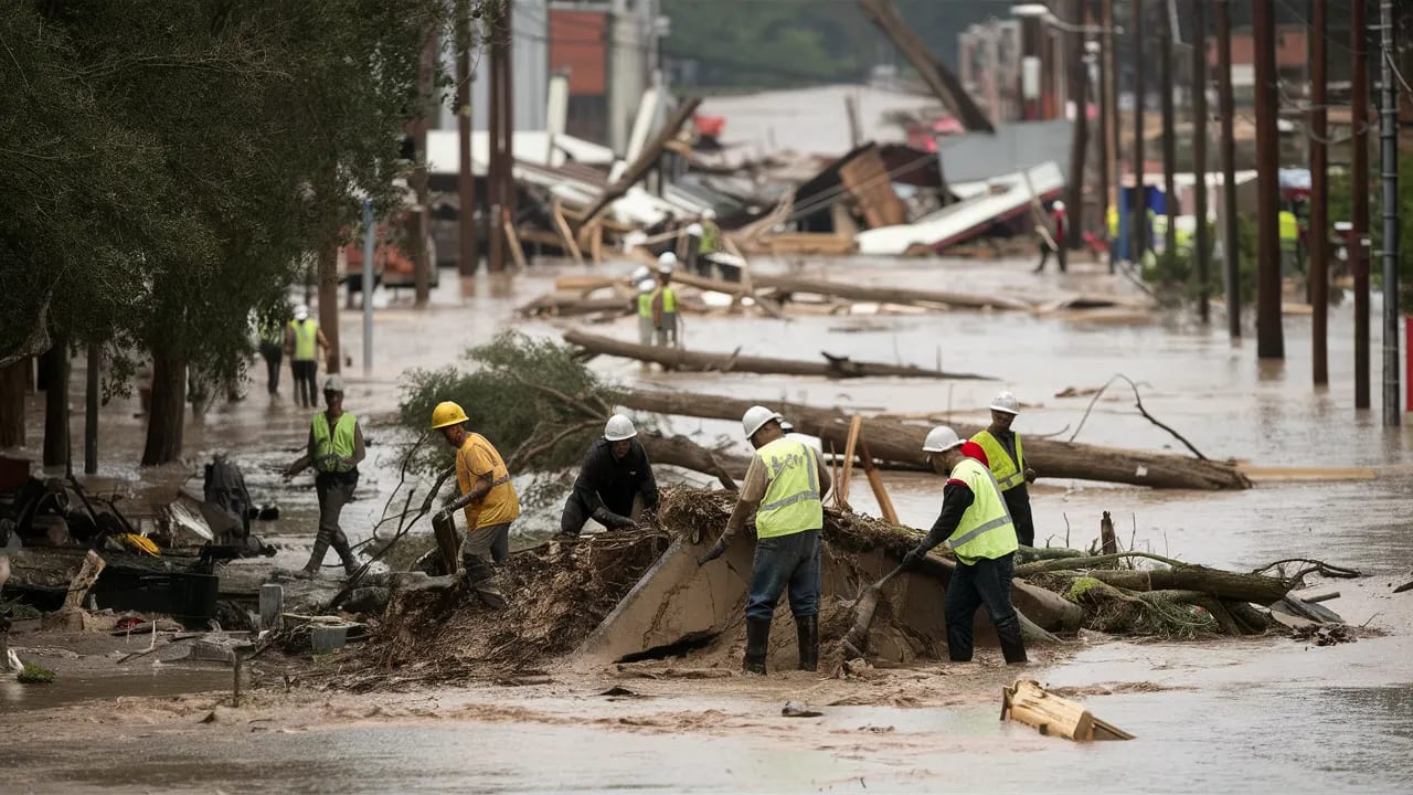
Two inches of rain spread across a day is not the same hazard as two inches falling in one hour over pavement, steep terrain, or a burn scar.
This guide answers a very specific search question: why does rainfall rate matter more than rainfall total for flash flooding. It is written for drivers, hikers, homeowners near small creeks, urban commuters, and anyone trying to judge whether a heavy shower is just rain or a flood risk, so the emphasis is practical: what to check, what to ignore, and when to change plans before the weather becomes a problem. Learn more in April 2026 Upper Midwest Wet Pattern: Travel, Fields, and Flooding After a Very Wet Month.
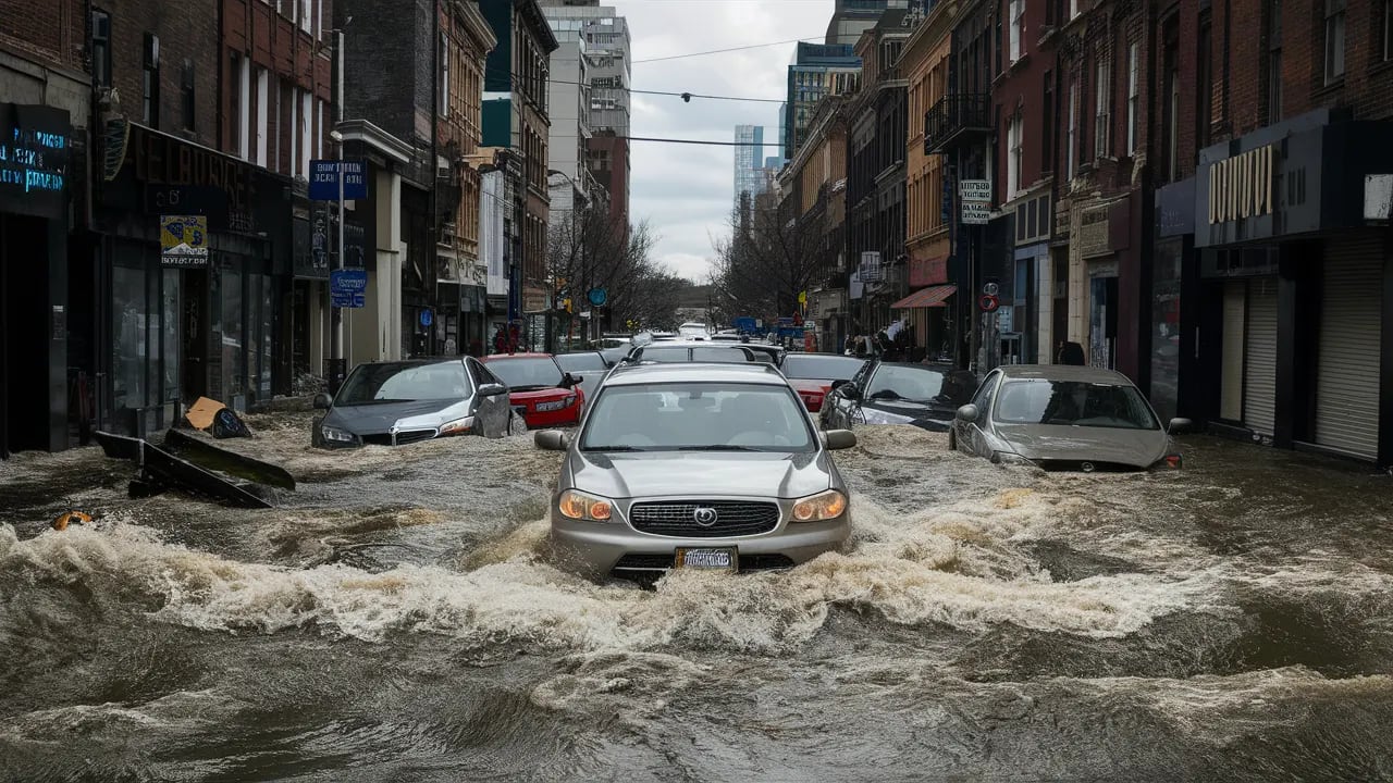
Rainfall totals are useful, but flash flooding is often about intensity and location. Drainage systems have limits. Soils can seal, slopes can shed water quickly, and a narrow storm can overwhelm one neighborhood while another stays merely wet.
The better question is "how fast will rain fall where runoff is most sensitive." That shift helps explain why flood warnings can appear even when the daily total does not sound historic.
Quick Answer
Flash flood risk rises when rainfall rate exceeds the ability of soil, channels, drains, and terrain to absorb or move water safely. The fastest way to apply that idea is to compare the headline forecast with the smaller signals that control your actual exposure. A daily icon is a starting point, not the decision.
For most readers, the useful workflow is simple: check the official local forecast, scan the hourly details, identify the one hazard that can break your plan, and choose a backup before the forecast window becomes urgent. That habit turns weather from a vague worry into a manageable planning input.
Why This Forecast Niche Matters
Niche weather questions matter because people rarely experience weather as a regional average. You experience it in a bedroom, on a sports field, on a specific bridge, in a valley, at a venue, or in a neighborhood that drains poorly. Two inches of rain spread across a day is not the same hazard as two inches falling in one hour over pavement, steep terrain, or a burn scar.
That is why broad forecast summaries can feel wrong even when meteorologists did their job. The public forecast may describe the air mass correctly while missing the exact surface, building, slope, road, or schedule that controls your risk. The goal is not to outguess the forecast. The goal is to read the part of the forecast that matches your exposure.
The Weather Setup Behind the Problem
Hourly rainfall rate
Start with hourly rainfall rate. High short-duration rates overwhelm drainage faster than gentle long-duration rain.
Training storms
Training storms is one of the first details to check. Cells moving over the same area repeatedly create local totals that broad forecasts can miss.
Soil saturation
Do not treat soil saturation as background noise. Wet soil accepts less new water, increasing runoff.
Impervious surfaces
For this topic, impervious surfaces often separates a routine day from a day that needs a plan. Pavement and roofs send water directly into drains and streets.
Burn scars
The forecast detail most people skip is burn scars. Recently burned land can repel water and produce debris flows.
Small basin response
Use small basin response to translate "why does rainfall rate matter more than rainfall total for flash flooding" into a practical decision. Creeks and washes can rise quickly before large rivers respond.
A 72-Hour Planning Workflow
The best weather decisions usually start before the final forecast is perfect. At 72 hours, you are not looking for certainty. You are looking for the main scenario, the plausible failure mode, and the cost of waiting.
- Check hourly rain rates and flood watches, not only daily accumulation.
- Avoid low-water crossings when thunderstorms are nearby, even before water covers the road.
- Know whether your route includes underpasses, washes, steep canyons, or poor drainage intersections.
- Treat repeated heavy showers over the same place as a higher risk than one passing shower.
- Move vehicles from flood-prone curbs or garages before the heaviest band arrives.
- Use official warnings for action because radar-estimated rain can change fast.
How to Read the Hourly Forecast
Open the hourly forecast and find the period that overlaps your real decision. For why does rainfall rate matter more than rainfall total for flash flooding, the daily summary can hide the most important part of the day. The relevant hour may be overnight, during school pickup, at ceremony time, near a commute, or just after a front passes.
Read the variables in pairs. Temperature plus dew point explains comfort better than temperature alone. Wind speed plus gusts explains exposure better than a single wind number. Rain chance plus rainfall rate explains disruption better than a droplet icon. Cloud cover plus wind direction can explain why one neighborhood stays gray while another clears.
Then ask whether the forecast is describing a gradual hazard or a threshold hazard. Gradual hazards build through the day and give you chances to adjust. Threshold hazards can flip the plan quickly: lightning close enough to hear, water over a road, wind strong enough to make a tent unsafe, or smoke mixing to the surface.
Local Clues That Confirm the Forecast
Local clues matter because official observations are often several miles away from the exact place where you feel the weather. These signs do not replace the forecast, but they help you decide whether the atmosphere around you is behaving as expected.
- Storm drains gurgle or back up.
- Water sheets across parking lots within minutes.
- Small creeks turn muddy and rise quickly.
- Rain echoes keep rebuilding upstream.
- Debris collects at curb inlets and culverts.
Common Mistakes
- Assuming a modest daily total means no flood risk.
- Driving through water because the road is familiar.
- Ignoring upstream rainfall when your location is dry.
- Treating urban street flooding as harmless.
- Waiting to leave a trail or canyon until heavy rain reaches your exact spot.
What to Watch Next
NWS flood safety guidance stresses avoiding flooded roads, watching rainfall rate, and responding quickly to warnings. Use it as background context, then rely on your local forecast and warnings for timing.
NOAA highlighted spring 2026 concerns that included flood risk, drought pressure, and warmer-than-normal seasonal odds for parts of the country. Use it as background context, then rely on your local forecast and warnings for timing. Learn more in NOAA Spring Outlook 2026: Flood, Drought, and Heat Signals to Watch Locally.
If the source is a seasonal or climate product, use it to frame the background risk. If the source is a safety page, use it to define action thresholds. For day-to-day timing, check the National Weather Service point forecast, local watches and warnings, radar, and nearby observations.
Related OpticWeather Guides
- Chance of Rain vs Probability of Precipitation
- NOAA Spring Outlook 2026: Flood, Drought, and Heat Signals to Watch Locally
- How to Read Weather Forecast
- Forecast Interpretation and Accuracy
- Weather Safety and Preparedness
Frequently Asked Questions
Is this the same as the regular weather forecast?
No. The regular forecast gives the broad expected conditions. This guide explains how to interpret those conditions for a narrow decision where timing, exposure, and local details matter.
Which forecast number should I check first?
Start with the number that most directly controls the hazard. For this topic, that means the signals listed above, especially hourly rainfall rate and training storms. After that, check the hourly timing and any official alerts.
Why do weather apps disagree on this?
Apps can use different models, update schedules, icons, and thresholds. One app may smooth a local hazard into a broad daily summary while another highlights the risky hour. When the stakes are high, compare the app with official forecasts and observations.
When should I stop waiting for a clearer forecast?
Stop waiting when the cost of delay becomes higher than the cost of preparing. If rentals, travel, safety equipment, vulnerable people, animals, or outdoor crews are involved, set a decision deadline before the forecast window arrives.