article
Smoke Aloft vs Surface Air Quality: Why the Sky Looks Hazy When the AQI Seems Fine
A wildfire smoke forecast guide explaining smoke aloft, surface AQI, haze, visibility, health decisions, and why weather apps may disagree.
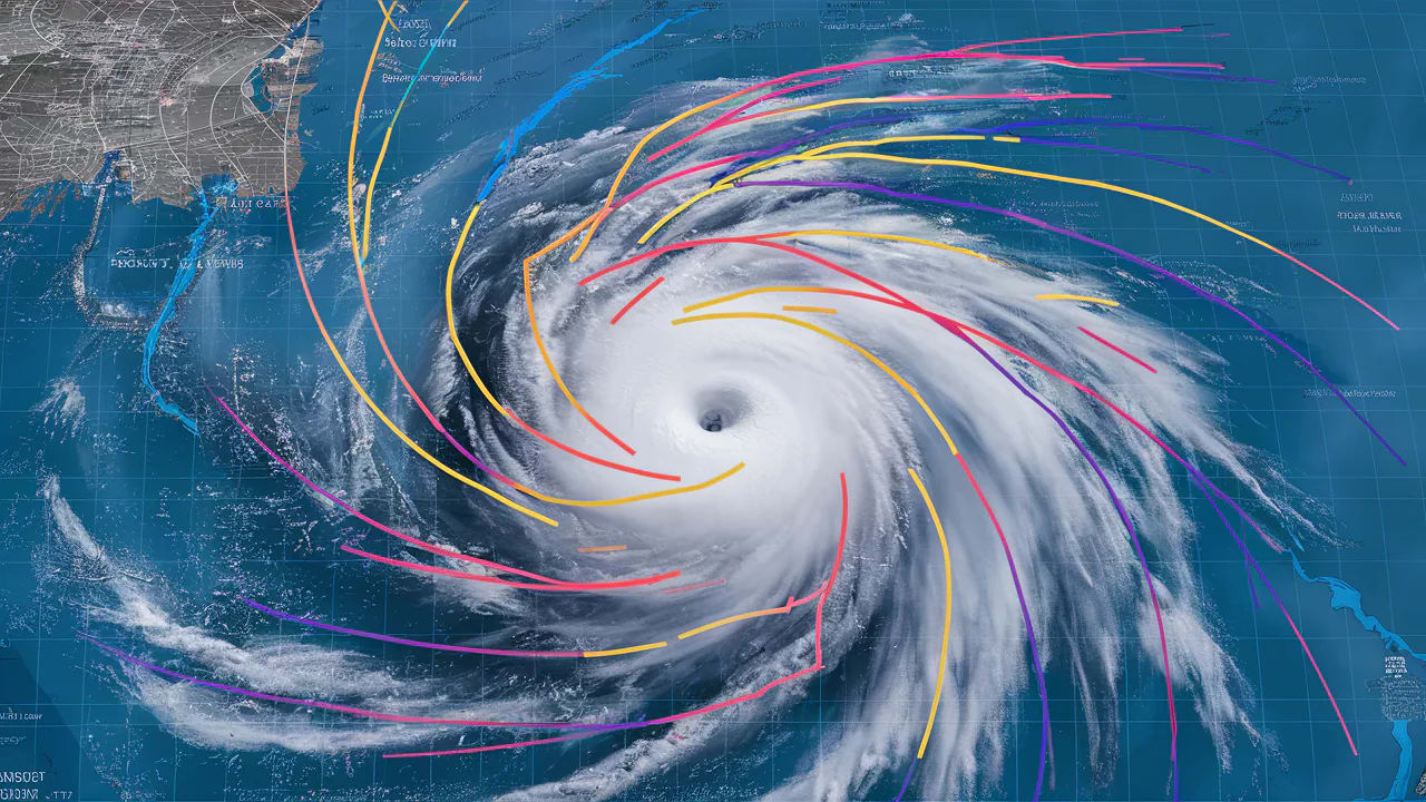
Smoke can travel above your head without mixing to the ground, so the sky may look milky while surface air monitors still report acceptable AQI.
This guide answers a very specific search question: why does the sky look smoky when the air quality index is good. It is written for runners, parents, photographers, commuters, asthma-sensitive households, and anyone comparing a hazy sky with a green AQI number, so the emphasis is practical: what to check, what to ignore, and when to change plans before the weather becomes a problem.
Wildfire smoke is layered. Some plumes stay aloft, where they dim the sun and change sky color. Other plumes mix down to breathing level and affect surface particulate readings. Weather apps often display one slice of that story, which is why haze, smell, and AQI can seem mismatched.
The practical question is whether smoke is visually present, whether it is reaching the surface, and whether it is expected to mix down later as winds, temperature, and boundary-layer depth change.
Quick Answer
Haze describes what light is passing through; AQI describes what monitors are measuring near the ground. The fastest way to apply that idea is to compare the headline forecast with the smaller signals that control your actual exposure. A daily icon is a starting point, not the decision.
For most readers, the useful workflow is simple: check the official local forecast, scan the hourly details, identify the one hazard that can break your plan, and choose a backup before the forecast window becomes urgent. That habit turns weather from a vague worry into a manageable planning input.
Why This Forecast Niche Matters

Niche weather questions matter because people rarely experience weather as a regional average. You experience it in a bedroom, on a sports field, on a specific bridge, in a valley, at a venue, or in a neighborhood that drains poorly. Smoke can travel above your head without mixing to the ground, so the sky may look milky while surface air monitors still report acceptable AQI.
That is why broad forecast summaries can feel wrong even when meteorologists did their job. The public forecast may describe the air mass correctly while missing the exact surface, building, slope, road, or schedule that controls your risk. The goal is not to outguess the forecast. The goal is to read the part of the forecast that matches your exposure.
The Weather Setup Behind the Problem
Vertically integrated smoke
Start with vertically integrated smoke. This product can show smoke through a column of atmosphere, including smoke aloft.
Near-surface smoke
Near-surface smoke is one of the first details to check. This is more directly tied to what people breathe.
Wind shift timing
Do not treat wind shift timing as background noise. A low-level wind shift can bring smoke down or move it away quickly.
Mixing height
For this topic, mixing height often separates a routine day from a day that needs a plan. Daytime mixing can connect aloft smoke with surface air in some setups.
PM2.5 observations
The forecast detail most people skip is pm2.5 observations. Fine particles are the main health concern in wildfire smoke.
Smell and visibility
Use smell and visibility to translate "why does the sky look smoky when the air quality index is good" into a practical decision. A smoky smell or falling visibility often means smoke is affecting the surface.
A 72-Hour Planning Workflow
The best weather decisions usually start before the final forecast is perfect. At 72 hours, you are not looking for certainty. You are looking for the main scenario, the plausible failure mode, and the cost of waiting.
- Compare AQI observations with a smoke forecast that separates surface smoke from smoke aloft.
- Use the more protective signal for sensitive groups when the sky, smell, and monitors disagree.
- Schedule outdoor exercise for times when near-surface smoke is lowest, not when the sky simply looks best.
- Keep indoor air cleaner before smoke arrives by closing windows and setting filtration plans.
- Watch wind shifts because smoke conditions can change faster than daily forecast summaries suggest.
- Use visibility and odor as prompts to recheck AQI rather than as precise pollution measurements.
How to Read the Hourly Forecast
Open the hourly forecast and find the period that overlaps your real decision. For why does the sky look smoky when the air quality index is good, the daily summary can hide the most important part of the day. The relevant hour may be overnight, during school pickup, at ceremony time, near a commute, or just after a front passes.
Read the variables in pairs. Temperature plus dew point explains comfort better than temperature alone. Wind speed plus gusts explains exposure better than a single wind number. Rain chance plus rainfall rate explains disruption better than a droplet icon. Cloud cover plus wind direction can explain why one neighborhood stays gray while another clears.
Then ask whether the forecast is describing a gradual hazard or a threshold hazard. Gradual hazards build through the day and give you chances to adjust. Threshold hazards can flip the plan quickly: lightning close enough to hear, water over a road, wind strong enough to make a tent unsafe, or smoke mixing to the surface.
Local Clues That Confirm the Forecast
Local clues matter because official observations are often several miles away from the exact place where you feel the weather. These signs do not replace the forecast, but they help you decide whether the atmosphere around you is behaving as expected.
- The sun looks orange but there is no smoke smell.
- Mountains fade even when nearby air feels clean.
- Smoke smell arrives after sunset as the boundary layer changes.
- AQI differs sharply between valley and ridge monitors.
- Ash is absent even though the sky is milky.
Common Mistakes
- Assuming a hazy sky always means unhealthy surface air.
- Assuming green AQI means the whole day will stay safe.
- Using only a citywide monitor for a valley, canyon, or downwind neighborhood.
- Opening windows because the temperature is pleasant while smoke is expected to mix down later.
- Forgetting that sensitive people may react before a general alert is issued.
What to Watch Next

AirNow guidance explains how smoke can affect air quality and why surface observations can differ from smoke seen aloft. Use it as background context, then rely on your local forecast and warnings for timing.
NIFC outlooks connect fuel dryness, wind patterns, lightning, and seasonal precipitation trends to significant wildland fire potential. Use it as background context, then rely on your local forecast and warnings for timing. Learn more in Dry Lightning Wildfire Risk: How Thunderstorms Can Start Fires Without Helpful Rain. Learn more in Red Flag Warning Meaning: Wind, Humidity, and Fuels Explained Without Jargon.
If the source is a seasonal or climate product, use it to frame the background risk. If the source is a safety page, use it to define action thresholds. For day-to-day timing, check the National Weather Service point forecast, local watches and warnings, radar, and nearby observations.
Related OpticWeather Guides
- Western Wildfire Weather 2026: Snowpack, Drought, Wind, and the Forecast Signals That Matter
- Red Flag Warning Meaning: Wind, Humidity, and Fuels Explained Without Jargon
- How to Read Weather Forecast
- Forecast Interpretation and Accuracy
- Weather Safety and Preparedness
Frequently Asked Questions
Is this the same as the regular weather forecast?
No. The regular forecast gives the broad expected conditions. This guide explains how to interpret those conditions for a narrow decision where timing, exposure, and local details matter.
Which forecast number should I check first?
Start with the number that most directly controls the hazard. For this topic, that means the signals listed above, especially vertically integrated smoke and near-surface smoke. After that, check the hourly timing and any official alerts.
Why do weather apps disagree on this?
Apps can use different models, update schedules, icons, and thresholds. One app may smooth a local hazard into a broad daily summary while another highlights the risky hour. When the stakes are high, compare the app with official forecasts and observations.
When should I stop waiting for a clearer forecast?
Stop waiting when the cost of delay becomes higher than the cost of preparing. If rentals, travel, safety equipment, vulnerable people, animals, or outdoor crews are involved, set a decision deadline before the forecast window arrives.